

Emsworth is one of England's best examples of a post-Norman planned new town.
The Normans and their Plantagenet successors were energetic
new town planners. In the lee of their castles, great lords
laid out towns which grew into cities. Lesser lords of the
manor laid out smaller townships to increase their income,
adding markets to stimulate trade.
Chichester Harbour's original south-west settlement was at
Warblington, active in Roman and Saxon times. The 1100s
global fall in sea level (which created Calais across the
channel) left the Warblington channel too shallow for boats.
It also left a narrow gravel ridge between the previously
inundated River Ems and Westbrook streams (the high tide
limit then almost reaching Westbourne) suitable for
building.
Settlement beginning in King John's reign (1199-1216) was
confirmed by his son Henry Ill (1216-72) in a 1231 charter
mentioning Emelesworth. A subsequent 1239 charter to lord of
the manor Herbert Fitzherbert allowed the holding of a
market every Wednesday. In these years, Fitzherbert laid out
his township around a T-junction with South Street leading
to the Quay, allowing a central triangle (The Square) for
animal and produce trading.
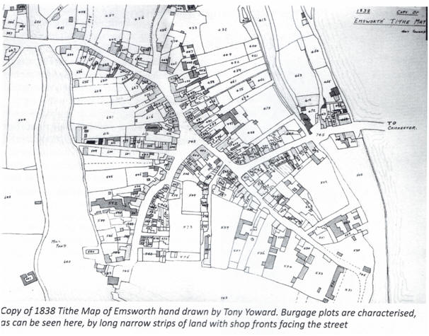
Following the Normandy pattern, narrow, uniform building
strips were demarcated on the street frontages. Known as
burgage plots (from the burh(g) word for town), they allowed
for a
13 ft shop frontage with integral side alley allowing access
to a rear courtyard with stores and workshops. Most
alleyways are today visible as front doors, but some survive
as at Citrus Flowers and Heidi's Patisserie. These 13-foot
proportions are visible today even in 'modern' rebuilding
such as the Damar Hairdresser's parade.
n the north parade, the former Hutchin's premises have
reverted to the two original shops with their alleys merged
to form the entrance. The corner with Queen Street preserves
the layout, with a sequence of street-fronting properties
running round to a covered alleyway.
Another vestige is in gable-end pitched roofs only one
burgage plot wide, resembling what would have been the
originals at lower levels. The most visible is the side
building of the Rowans Hospice shop in South Street. Another
peeps above the Georgian facade of The Crown Hotel to the
(viewer's) right of the building.
A map in A J C Reger's book A Short History of Emsworth and
Warblington shows the approximate extent of the planned
layout. It runs along the High Street from the West Street
junction with North Street round to the top of what used to
be Dolphin Hill (now Queen Street). On the south it runs
round The Square, past Tower Street and along Sw(e)are Lane
(now King Street).
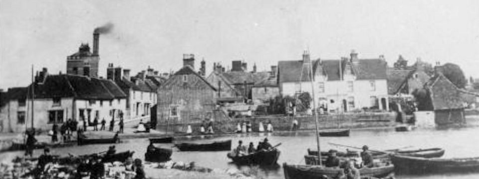
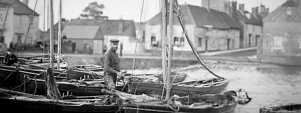
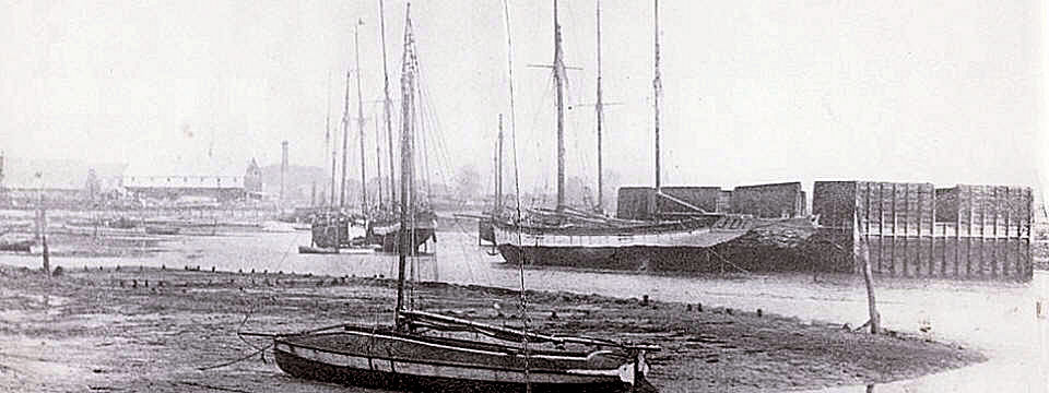
The large (for its time) settlement flourished, as it could
hardly fail to do in such a beneficial location. Straddling
the main South Coast road, its sea access provided fishing,
import and export trading, and ship building.
With comparatively little redevelopment over the centuries,
Emsworth demonstrates its growth through individual
buildings and sequences. And the centre remains much older
than it looks with ancient pitched roofs hiding behind
Georgian facades and their cosmetic parapets, as with the
Emsworth Hardware and Emsworth Travel blocks on one side of
the High Street and the Crown Hotel on the other.
The planned town's layout can be seen on maps viewable on
the www.historicengland.org.uk website.
Author: Bob Smyth
Published here with permission of the author, first
published in The Emsworth Echo, November 2018, the annual
bulletin of the Emsworth
Maritime & Historical Trust